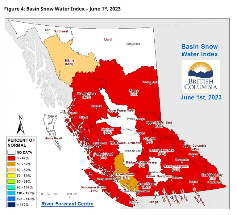
Snowpack levels in the East Kootenay are substantially below normal for this time of year.
The BC River Forecast Centre released their latest snow basin index last week, covering data up to June 1st.
Measurements show the East Kootenay region is currently at 1 per cent of normal levels, while the snowpack in the Upper Columbia is at 24 per cent of normal.
The Forecast Centre says BC experienced the hottest May on record, generating extremely rapid melt of the provincial snow pack and creating flood risk or high streamflow advisories throughout last month.
Overall, the snowpack across the province is averaging 29 per cent of normal levels.
Forecasters warn there is a higher risk for long-term significant drought due to the rapidly diminished seasonal snow pack this year.
You can find more details from the BC River Forecast Centre by clicking here.
(Graphic Credit: BC River Forecast Centre.)


Comments